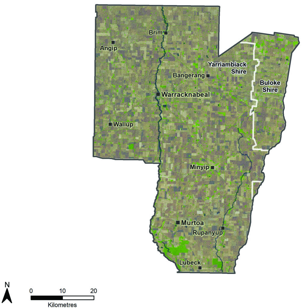
The Yarriambiack Local Area extends north from the Barringgi Gadyin (Wimmera River) to just north of Brim. It covers the southern part of Yarriambiack Shire and western portion of Buloke Shire. | |||
Yarriambiack Creek is the major natural feature bisecting the Local Area, flowing north into the Mallee Catchment Management Authority (CMA) region to terminate at Lake Coorong northeast of Hopetoun. Dunmunkle Creek also flows in a northerly direction in the eastern part of the Local Area. Agriculture, specifically grain production, is the primary source of income. The Wimmera Mallee Pipeline has facilitated the development of intensive animal industries, mostly pigs and ducks.
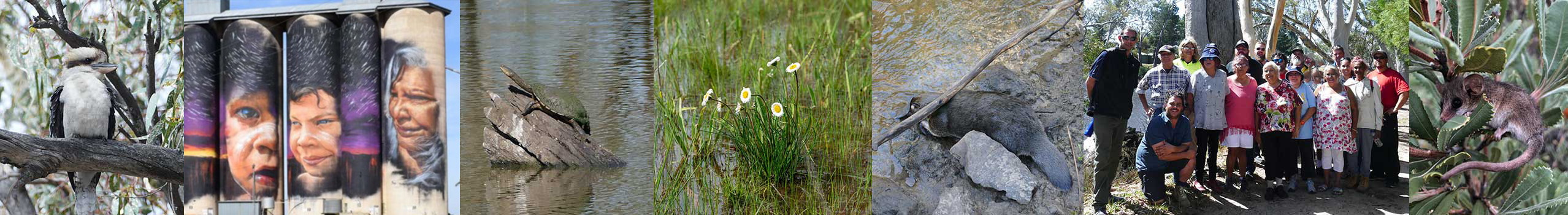
The Yarriambiack Local Area has a rich cultural history with First Nations people living traditionally up until the 1930s. The Yarriambiack and Dunmunkle Creeks were originally inhabited by the Wotjobaluk people. The many scarred trees and middens present provide evidence of the importance of this area to Aboriginal people. Barrabool Flora and Fauna Reserve is a distinctive place that contains over 120 scarred trees and some of the most significant artefact scatters in the region.
The Yarriambiack and Dunmunkle Creeks provide two waterways of largely connected riparian vegetation running south to north. They provide ecological links through a highly agricultural landscape. The creeks are hydrologically rare systems within south-east Australia. They are episodic distributaries of the Barringgi Gadyin (Wimmera River), meaning they flow away from the river, only receiving flows when the river has high flows and floods.(87)
Grampians Wimmera Mallee Water (GWMWater) supplies recreational water from the Wimmera Mallee Pipeline to weir pools on the Yarriambiack Creek at Warracknabeal and Brim, Lake Marma at Murtoa and Watchem Lake. This water provides environmental benefits, recreational opportunities for local communities and attracts visitors. The limited places in the Yarriambiack where surface water is regularly present have become a focus for the local community. There is passionate interest in their condition and management. Water-skiing, camping and fishing are popular at the Warracknabeal and Brim weir pools. Fishing is also popular at Jack Emmett Billabong on the Dunmunkle Creek at Rupanyup and Lake Marma.
Threatened species have also been recorded along or in the catchment of both creeks including species listed under the Environment Protection and Biodiversity Conservation Act 1999 such as the turnip copperburr (Sclerolaena napiformis), winged pepper-cress (Lepidium monoplocoides), slender darling-pea (Swainsona murrayana), Australasian bittern (Botaurus poiciloptilus), Mallee emu-wren (Stipiturus mallee), Wimmera rice-flower (Pimelea spienscens subsp. publiflora) and growling grass frog (Litoria raniformis).
Nationally threatened ecological communities include Buloke Woodlands of the Riverina and Murray-Darling Depression Bioregions and Natural Grasslands of the Murray Valley Plains.
Scattered wetlands exist in Crown Reserves and occasionally on private land. Some of these receive environmental water from the Wimmera Mallee Pipeline to help retain biodiversity values in the largely agricultural landscape.
Many small, fragmented pockets of native vegetation remain on private land and roadsides. These are predominantly Buloke Woodlands, a threatened ecological community, and some represent the best examples of these communities in the Wimmera. There is also high-quality endangered vegetation on private land, particularly around the Barrabool and Marma state forests.
Yarrilinks is a well-established, community run, Landcare network covering the southern Yarriambiack region. It aims to improve the connectivity of native vegetation in and around the Yarriambiack and Dunmunkle Creeks and along roadsides. In some cases, Landcare groups volunteer their time in management activities around weed control. The Yarriambiack Creek Advisory Group focuses on the integrated management of the Yarriambiack Creek across the Wimmera and Mallee CMA areas. The group has a keen interest in providing permanent water at towns along the creek.
The Birchip Cropping Group and Victorian No–Till Farmer’s Association are two of the most active agricultural groups in the area. They both undertake a range of progressive and innovative trials to support farmers to improve productivity. Improving the environmental and economic sustainability of farms is a key focus.
Region quick stats
 |
Land area | 374,671 hectares(25) |
 |
Population | 5,100 (approximate)(68) Second lowest population density in Victoria |
 |
Population trend | Declining. Aging population |
 |
Main towns | Warracknabeal, Murtoa, Minyip, Rupanyup, Brim |
 |
Climate | Semi-arid. Summer temperatures can reach over 40 degrees and regular frosts are experienced in winter. Average annual rainfall is around 425 mm. |
 |
Land use | 89% of the area is dryland broadacre cropping.(25) |
 |
Main industries |
Agriculture (27.5% of workers): cropping, lambs and wool, major producer and exporter of hay, intensive animal industries. Healthcare and social services (19.8% of workers).(2) Tourism is an emerging industry: silo art trail, murals, lakes and weir pools, historic attractions like Murtoa’s stick shed. |
 |
Main natural features |
10.5% of the area is covered by native vegetation and waterways(25)
|
Assessment of current condition and trends
 Rivers and streams
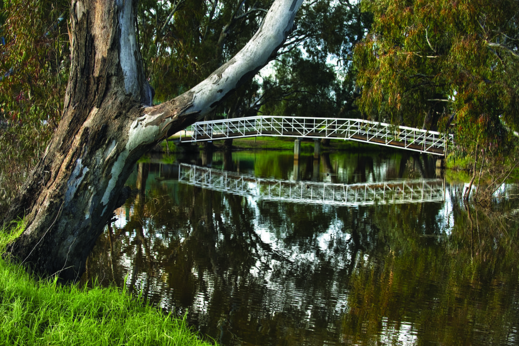
Yarriambiack Creek, Warracknabeal
Reduced rainfall and surface runoff in the upper Wimmera catchment have reduced flows to downstream waterways including the Yarriambiack Creek and Dunmunkle Creek. Given that natural flows are infrequent, water provided by stormwater and the Wimmera Mallee Pipeline is vital for providing environmental benefits and wellbeing benefits to local communities.
Remnant vegetation is present along most of Yarriambiack Creek and Dunmunkle Creek’s lengths. The overall health of the riparian vegetation along the Yarriambiack Creek is very good, with the dominant Black Box (Eucalyptus largiflorens) and River Red Gum (Eucalyptus camaldulensis) overstorey being very healthy despite ongoing dry conditions. There is good connectivity from the headwaters to the lower catchment. Landholders, Landcare and Greening Australia have completed extensive revegetation projects, enhancing connectivity, often under the Yarrilinks Landcare Network banner.
All the Ecological Vegetation Classes along the Dunmunkle Creek are endangered in the Wimmera Bioregion and many along the Yarriambiack Creek are endangered or vulnerable. Weeds are also present, dominated by annual grasses with some noxious weeds present including African boxthorn (Lycium ferocissimum), Bathurst burr (Xanthium spinosum), horehound (Marrubium vulgare) and prickly pear cactus (Opuntia). Grazing by stock is impacting the quality of understorey in places along both creeks. Rubbish dumping and rabbits have also been observed in places.(87) (88)
The Dunmunkle Creek suffered modifications in the 1880s and 1900s to provide an efficient channel delivery system distributing water to farms as part of the Wimmera-Mallee Stock and Domestic Supply System. Channelisation, realignment, removal of large woody debris and progressive enlargement of the channel have significantly damaged the integrity of the creek.
Since the replacement of the channel supply system with the Wimmera Mallee Pipeline around 2010, community members have raised concerns about the ongoing role and management of Dunmunkle Creek. Some have expressed a need to minimise damage during floods. Some are keen to see the creek rehabilitated to a more natural waterway. These concerns have been exacerbated by flood events in the last decade that saw farm crops and parts of Rupanyup impacted. Since 2018, Wimmera CMA commissioned and completed a flood investigation, rehabilitation and restoration plan and waterway action plan in consultation with the local community. These plans provide the information needed to inform decisions by the community and waterway managers about the future management of the creek.
Wetlands
There are very few wetlands in this dry agricultural landscape, with 76 wetlands recorded on public and private land, some contained in small Crown bushland reserves. Most of these wetlands are modified. An analysis of 2017 aerial photography found that half were wholly or partially covered by a crop, 29 contained a dam and 31 contained a drain or levee. Only 16 wetlands were unmodified. Most typically only fill due to local runoff during exceptionally wet conditions. Climate change, dry years, modifications to the wetland basin and drainage and improvements to paddock management has seen their frequency of filling decline.
About 10 wetlands are supplied with water from the Wimmera Mallee Pipeline when allocations are sufficient. Ecological surveys have found that these wetlands contain a surprising diversity of native flora and fauna, including threatened species, despite their isolation and size.(73)
Individual landholders have also used GWMWater allocations to fill small frog ponds to support wildlife.
 Land
Land
The gross value of agricultural commodities in 2015-16 was $103 million of which $68 million was from broadacre crops, $20 million from livestock, $8 million from hay and $7 million from livestock products. This compares with $216 million in 2010-11. The difference is explained by a cropping income of around $191 million in 2010-11. Variations are likely to be due to seasonal conditions affecting yield and commodity prices, with 2015 representing a particularly dry year.
Soils in this Local Area are highly susceptible to wind erosion, surface and subsurface alkalinity, compaction, surface and subsurface sodicity.(89) Annual cropland management transect analysis indicates that between 1996 and 2009, there was a clear trend towards increased stubble retention peaking at 83% of paddocks in 2009. Since the Millenium Drought, stubble retention and removal rates have become more variable. More stubble is being removed by burning and cultivation in the autumn following a wet season due to issues associated with heavy stubble loads. For example, less than 2% of the surveyed area had stubbles removed by burning and cultivation in 2015 and 2016 following low rainfall growing seasons, while in 2014 and 2017 it increased to 18% and 13% respectively.
 Biodiversity
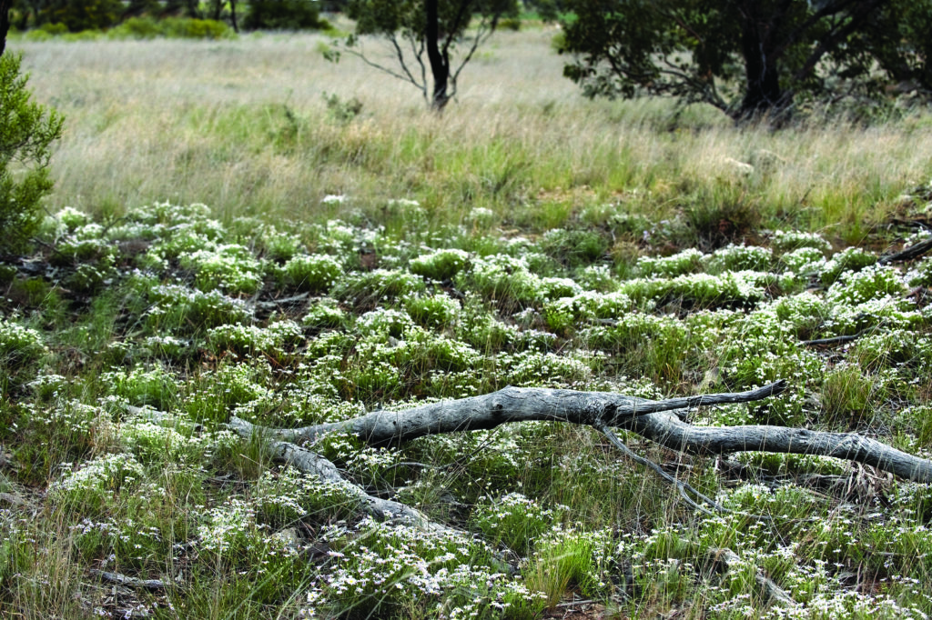
Remnant vegetation and wildflowers on a Yarriambiack roadside
The Victorian Land Use Time Series shows that over the period 1985-90 to 1990-95, there was a 13,540 hectare decline in native grass herb and 1,136 hectare decline in scattered native trees. Dryland cropping increased by 15,000 hectares over the same period. Land use has remained relatively stable since then. Only 10% of the local area contains native vegetation and remaining vegetation is significant for providing habitat to allow species to persist in the landscape. Roadsides contain some of the last significant remnants of native vegetation, often on 3 and 5 chain roads.
The remnant patches of vegetation along creeks and roadsides provide important habitat, refuge and connectivity for native species, including threatened species in this largely cleared agricultural area. Maintaining and improving the integrity of these remnants will become increasingly important under climate change scenarios due to increased rainfall, fires, droughts or other climate variability.
The buloke woodlands community is listed as endangered under the Commonwealth Environment Protection and Biodiversity Conservation Act 1999, existing in small (<200 hectares) and isolated patches. There are few good quality remnants remaining with the associated understorey often missing. Ongoing degradation through weed and rabbit invasion and grazing continues.
Many landholders have used Wimmera CMA’s assistance to improve the management of buloke woodlands as well as riparian areas along the Yarriambiack and Dunmunkle Creeks. Further efforts are required to connect remnant vegetation in reserves and private land using roadsides.
Major threats and drivers of change
Climate change is a significant threat to natural assets and soil health in the Yarriambiack Local Area. Climate change is impacting on flows to Yarriambiack Creek, Dunmunkle Creek and scattered wetlands. This impacts on the frequency, volume and quality of water in these waterways and in turn affects environmental condition, recreational values and community wellbeing.
Hotter and drier conditions also place increased stress on the health of waterways, fragmented native habitat remnants and wildlife in the Yarriambiack Local Area. The behaviour of problem weeds may also change, with incursions of new problem weeds and the spread of existing weeds likely under changed climate scenarios.
Climate change also has a strong influence on farming practices, with many farmers adapting management techniques and technology to retain soil moisture with drier growing seasons.
Wind erosion of valuable topsoil is an ongoing threat, with the potential to be exacerbated by climate change if ground cover is low and conditions are dry. The threat of soil erosion has significantly decreased over the past two decades, with most farmers adapting practices to retain ground cover throughout the year. This threat increases following high rainfall growing seasons when more paddocks are burnt or cultivated to remove heavy stubbles in autumn prior to sowing. This leaves soils vulnerable to erosion until cover of the new crop is established.
Threats to scattered patches of remnant vegetation and linear sections along creeks and roadsides include weed incursions, stock access and fragmentation. Rabbits and kangaroos also place pressure on vegetation regeneration and growth. Incremental loss of native vegetation has been observed, including loss of paddock trees and grasslands by fire or machinery, roadside firewood collection and cropping of roadsides.
Increased access to creeks and wetland and bushland reserves has the potential to impact on the biodiversity, water quality and amenity of these sites. The community has a strong desire to access public natural areas, particularly creeks and lakes, for recreation and to attract tourists. This access needs to be managed so it is safe and does not impact on environmental condition or amenity.
Desired outcomes for the future
Outcomes to be achieved in 20+ years
- Habitat condition and connectivity is enhanced along the Yarriambiack Creek, Dunmunkle Creek and between patches of remnant habitat.
- Soils support productive agriculture and healthy, functioning natural environments.
- Significant vegetation and species persist in the Yarriambiack landscape.
Outcomes to be achieved in 6 years
- The condition of remnant buloke woodlands is protected and improved.
- Most paddocks have at least 70% ground cover maintained throughout the year.
- More farmers use management practices that improve environmental health.
- The geomorphology and habitat of Dunmunkle Creek is restored to a more natural waterway.
- No new pest plant and animals are established beyond small, localised populations.
- Water delivered to wetlands, drought refuges and pools in Yarriambiack Creek and Dunmunkle Creek maintain environmental, cultural, social and economic values.
- Alternatives to stubble burning and cultivation following wet seasons are explored.
- Improve habitat quality and manage the impacts of recreation and access to waterways and public reserves, including Yarriambiack Creek, Dunmunkle Creek and Barrabool Flora and Fauna Reserve.
Priority directions
Integrated Catchment Management (ICM) in this area will focus on:
- Barengi Gadjin Land Council (BGLC), farmers, Landcare groups, government agencies, Wimmera CMA and stakeholder organisations working together to build corridors of well managed vegetation between private and public land, particularly the Yarriambiack Creek, Dunmunkle Creek and wetlands and remnant native buloke and box woodlands.
- Landcare groups, Wimmera CMA, Agriculture Victoria, BGLC and farmers working together to improve knowledge and techniques that balance ground cover, farm profitability and improved environmental outcomes.
- Community groups, BGLC, Yarriambiack Shire Council, Wimmera CMA and government agencies working together to add value to recreational water bodies through a combination of environmental improvements and improved management of recreation, access and impacts.