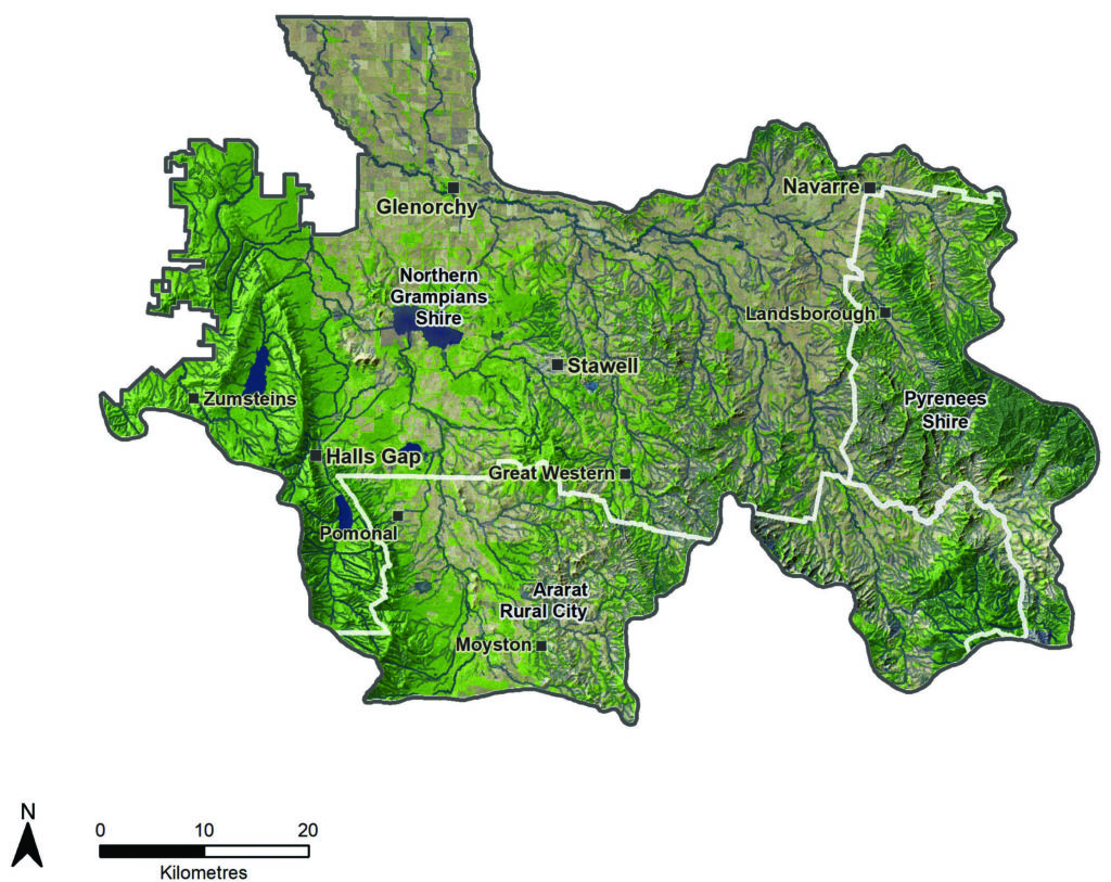
The Upper Catchment Local Area includes portions of the Northern Grampians and Pyrenees Shires and Ararat Rural City Council. The area comprises the upper catchment of the Barringgi Gadyin (Wimmera River), the northern section of Gariwerd (Grampians National Park) in the west and the Pyrenees range in the east. | |||
The country between the mountain ranges supports wool and fat lamb production and cropping in the alluvial valley floors. The area is also known for its vineyards, tourism and gold mining. Gariwerd (Grampians National Park) is one of the most significant parks in Victoria. “It is a symbolic Aboriginal cultural landscape, an ecological wonderland and an important visitor attraction for the region owing to beautiful vistas, natural features, remoteness and stunning flora and fauna”.(78) Over one million people visit Gariwerd (Grampians National Park) annually for recreation and tourism.
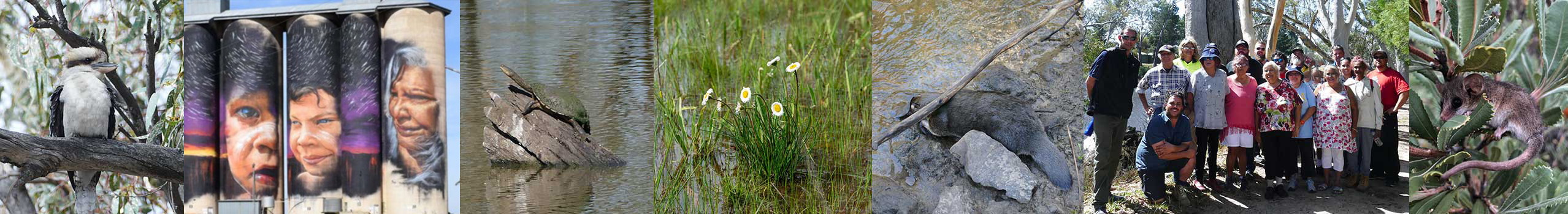
The Upper Catchment Local Area is a living cultural landscape with deep and continuing connections from Wotjobaluk people and Eastern Maar people. The Victorian Aboriginal Heritage Act 2006 recognises two Registered Aboriginal Parties, Barengi Gadjin Land Council Aboriginal Corporation and Eastern Maar Aboriginal Corporation, as the primary guardians, keepers and knowledge holders of Aboriginal Cultural Heritage for areas of the Upper Catchment. Connections between First Nations people and Country are reflected in many ways including artefacts, rock art, scar trees and creation stories featured around Gariwerd (Grampians National Park), the Pyrenees range, Lake Lonsdale, Lake Fyans and other waterways.
The population of the Upper Catchment Local Area is approximately 9,000 people. The upper catchment has committed Landcare Groups of mostly older members supported by the Project Platypus Landcare Network. Perennial Pasture Systems is a dynamic farmer group, carrying out research and providing information and support to local graziers and working collaboratively within the Landcare network.
The Barringgi Gadyin (Wimmera River)’s headwaters are in the Pyrenees Range at Mount Cole. Numerous tributaries arise in the steep hill country around Navarre, the Black Range Scenic Reserve, northern Gariwerd (Grampians National Park) and the western Pyrenees ranges.
Some streams flow into large water storages like Lake Bellfield, Lake Wartook and Lake Lonsdale, providing a regionally important source of water for a vast network of towns and farms distributed via the Wimmera Mallee Pipeline. Several streams also provide water for townships like Elmhurst, Buangor and Moyston. Lake Bellfield and nearby lakes and water storages are also major tourist destinations and recreational assets.
Waterways with particularly high environmental, social and economic value include the Barringgi Gadyin (Wimmera River), Glenlofty Creek, Mount Cole Creek, Concongella Creek, Mount William Creek, Fyans Creek, Millers Creek and the upper MacKenzie River.
The Upper Catchment comprises about 222 wetlands, a relatively small figure compared to the rest of the Wimmera region. More than a third are deeper lakes, while the remainder are shallow seasonal wetlands. Large lakes such as Lake Lonsdale, Lake Wartook, Lake Bellfield and Lake Fyans are hubs for recreation and tourism, particularly fishing. Lake Fyans attracts around 28,000 recreational users every year with expenditure around $2.5 million annually.
Groundwater on the eastern slopes of Gariwerd (Grampians National Park) is generally of better quality then elsewhere in the upper catchment and can discharge at the base of foot slopes.
The upper catchment’s large areas of native habitat are in Gariwerd (Grampians National Park) and other reserves, often on steep hill country. Most remnant native vegetation within agricultural areas is along waterways and road reserves. Much of the remnant native vegetation on private land is fragmented into smaller disconnected areas and is often found on sites with skeletal soils or otherwise low capability for agriculture. Vegetation beside waterways is predominantly River Red Gum overstorey, while Box Ironbark occurs elsewhere until the Grampians with its higher rainfall forests.
Gariwerd (Grampians National Park) supports a range of habitat types from montane habitat to gullies, wetlands, creeks, rocky outcrops, woodlands, heathlands and forests. This range of habitats supports extremely high diversity of habitats and species, including one third of Victoria’s native flora species and approximately 17% of Victoria’s wildlife species. This includes rare or endangered species and many endemic species found only in Gariwerd (Grampians National Park).(78)
The landscape between Gariwerd (Grampians National Park) and the Pyrenees ranges supports a diversity of habitats with six bioregions meeting within its extent. The area contains the western most and southern most extent of vulnerable box ironbark forest that extends across the inland slopes of Victoria and are important beyond the Wimmera catchment.(79) Box Ironbark forests are notable for their species richness. The varied tree species produce abundant nectar and pollen throughout the year, supporting many birds and other animals.
Threatened plants and animals in this Local Area include native orchids, southern brown bandicoot (Isoodon obesulus), smoky mouse (Pseudomys fumeus), mountain dragon (Rankinia diemensis), swift parrot (Lathamus discolor), plains rice-flower (Pimelea spinescens subsp. spinescens), button wrinklewort (Rutidosis leptorrynchoides) and western swamp crayfish (Gramastacus insolitus). Grey box grassy woodlands and derived native grasslands of south-eastern Australia and White Box-Yellow Box-Blakely’s Red Gum Grassy Woodland and Derived Native Grassland are nationally threatened ecological communities largely located on private land.
Region quick stats
 |
Land area | 368,851 hectares |
 |
Population | 9,000 (approximate)(68) |
 |
Population trend | A slight decrease around Stawell and Halls Gap and a slight increase for the Ararat region including Pomonal and Moyston(77) |
 |
Main towns | Stawell, Halls Gap, Great Western, Moyston, Pomonal, Landsborough, Glenorchy, Navarre |
 |
Climate | Semi-arid. Summer temperatures can reach over 40 degrees and regular frosts are experienced in winter. Average annual rainfall is around 532 mm. |
 |
Land use | 40% of the area is agricultural, comprising non-native pasture (21%) and cropping (19%)(25) |
 |
Main industries |
Agriculture, especially wool and lamb production, cropping and viticulture. Gold mining, manufacturing and tourism. |
 |
Main natural features |
58% of the area is covered by native vegetation and waterways(25)
|
Assessment of current condition and trends
 Rivers and streams
Mt William Creek, Mokepilly
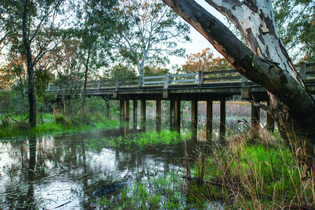
Stream condition varies considerably, with reasonably intact streams in parks and state reserves, while many in agricultural landscapes have eroding banks and beds. Rivers and streams located in Gariwerd (Grampians National Park) including the upper MacKenzie River, Fyans Creek and Golton Creek are generally very healthy and provide good quality water. The MacKenzie River supports the last remaining known population of platypus in the Wimmera region. Riparian zones provide important habitat and corridors for wildlife through the agricultural land lying between the parks and reserves.
After the creeks come out of the large public land reserves, they flow through agricultural land and are used as a water source for stock and domestic purposes and irrigating grapevines or perennial pastures. Many of the creeks have highly erosive soils, reduced vegetation cover and steep hills lead to fast flowing runoff that erodes creek banks and beds in a number of locations. This erosion incises and widens creeks, often creating deep gullies and creating impacts downstream in the Barringgi Gadyin (Wimmera River). Eroded sediment in fills deep pools in the Barringgi Gadyin (Wimmera River) and increases water turbidity and nutrient levels.
Stabilisation works over the past two decades has seen many highly eroding streams become more stable and riparian zones improved. Erosion control works are targeted at sites with the greatest potential to reduce sediment loads into streams.(80) Complementary work by Landcare, the Perennial Pasture Group and farmers to buffer waterways and retain ground cover on neighbouring paddocks has also seen improvements in many areas. Preventing erosion is a big task and there is more work to do to stabilise soils, reduce impacts on the Barringgi Gadyin (Wimmera River) and improve riparian areas.
Water quality problems are compounded in parts of the catchment by reduced flows in waterways due to the significant number of stock and domestic dams and larger irrigation dams (mainly for viticulture) that capture runoff upstream. Saline groundwater trickling into creeks during dry conditions also contributes to poor water quality in some streams. European carp (Cyprinus carpio) and mosquitofish (Gambusia holbrooki) also impact on water quality as well as native fish populations.
Wetlands
Of the 222 wetlands located in the Upper Catchment, about 30% are free from modifications such as dams, drains, cropping or levees. Impacts have increased since a 2004 survey was completed:
- The number of wetlands containing a dam has more than doubled, increasing from 44 to 97 wetlands impacted.
- The number of wetlands containing a drain has also doubled, increasing from 26 to 52 wetlands affected.
- Thirty-three wetlands were cropped in 2017 compared to only 12 in 2004.
- Fifty-four wetlands contain a levee.
The recreational use of some of the Local Area’s significant water bodies provide a significant contribution to the local economy.
 Land
Land
The steep hills of the Pyrenees ranges and Ararat Hills have red texture contrast soils that may be sodic, containing high sodium content, where rainfall is lower. These soils have characteristically light, sandy-loamy surface soils overlaying heavy clay subsoils that tend to be compacted with limited drainage. The dispersion of sodium in the subsoil can cause tunnel erosion and contribute to gully erosion, compaction and waterlogging. The steep gradients and soil types in the hill country are prone to water erosion, particularly if ground cover is low and the soil is exposed. Retaining adequate ground cover on paddocks to protect soils from eroding during rainfall or wind events is critical for retaining important topsoil, sustaining agricultural productivity and improving water quality in streams.
Partnerships between organisations like Perennial Pasture Systems, Project Platypus, Wimmera Catchment Management Authority (CMA) and Agriculture Victoria have seen significant improvements in ground cover levels in the Upper Catchment. Over many years, these groups have facilitated increased adoption of perennial pasture establishment, land-class fencing of hill country and waterways, stock containment areas, whole farm planning and dry matter management.
A landholder survey conducted periodically since 2002 found that there was a consistent increase over time in respondent’s reported knowledge levels related to establishing perennial pastures and using stock containment areas to manage stock in drier seasons.(4)
Members of Perennial Pasture Systems, who manage approximately 143,000 hectares (38%) of the Upper Catchment, have continued sowing perennials where seasonal conditions allow and integrated the use of grazing cereals and stock containment areas to provide year-round feed while maintaining ground cover. There has also been greater adoption of no-till methods of cropping.(81)
The Southern Wimmera Cropland Management Survey undertaken since 2015 has observed that the cropped area with stubble burning and cultivation in autumn fluctuates, declining after dry seasons and increasing following wet seasons due to challenges associated with heavy stubble loads.(82) Anecdotally, growers remove stubble to manage weeds (particularly herbicide resistant weeds) and control slugs prior to sowing canola. Growers also remove stubble when loads are heavy and provide a physical hindrance to sowing and crop establishment and to manage stubble- borne crop diseases.
Stubble removal in the Upper Catchment during the risky autumn months has been very low since the transect commenced in 2015. It was 10% and 13% of the surveyed area in 2017 and 2018 respectively, with virtually no stubble removal observed in the other survey years.
Salt at depth in the soil profile was mobilised by rising water tables following sustained wet years in the mid-1970s, causing dryland salinisation, impacting plant growth and exposing soil to erosion. Decreasing annual average rainfall and recharge control measures employed over the last 30 years have seen water table levels generally stabilised or falling and ongoing land salinisation is currently not a big issue.
A farmer survey conducted periodically since 2002 found that, among respondents(4):
- There were fewer full-time farmers and more part-time and hobby farmers;
- More respondents generated income off-property;
- The medium property size owned and managed by farmers has decreased.
The fringes of Gariwerd (Grampians National Park) and the Pyrenees ranges are popular with “tree changers” and there is increasing pressure for residential development of rural living zones. This sometimes presents land management challenges, with people’s different levels of skills and knowledge around land management, particularly managing weeds, rabbits and foxes. Some Upper Catchment Landcare groups have benefited from the influx of tree changers while others struggle to maintain membership. It will be important to balance the retention of prime agricultural land with the expansion of developments such as housing and industry, both of which can bolster regional communities and economies.
 Biodiversity
The Victorian Land Cover Time Series(25) shows that over the period 2015-19, about 40% of the Upper Catchment comprised agricultural land uses (21% pasture, 19% dryland cropping). Native vegetation covered 55% of the land area, comprised of native trees (31%), native scattered trees (5%) and native grass herb (19%).
The main changes in land use since 1985 include:
- Native cover has decreased by almost 40,000 hectares (16%), mostly attributed to the loss of native grass herb cover. Native scattered trees have also declined by about 1,600 hectares. Native tree cover has increased by 5% or almost 6,000 hectares.
- Dryland cropping has more than doubled, increasing by 37,000 hectares.
The total area covered by non-native pasture has stayed comparatively stable for the last ten years, covering around 78,000 hectares.
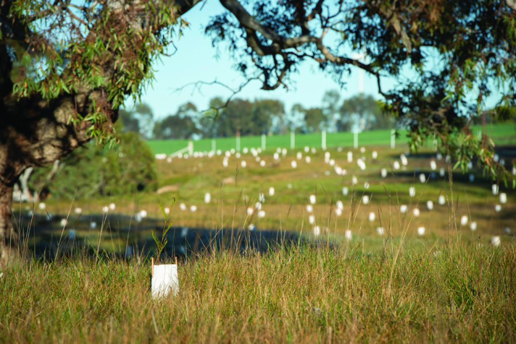
Six Mile Creek fencing and revegetation, Joel South
Extensive revegetation efforts to stabilise hillsides and saline groundwater levels, improve habitat connectivity and improve riparian areas along waterways have added to vegetation cover over recent decades. The bioregional significance of the Upper Catchment’s native vegetation has led to a collaborative effort by a broad group of stakeholders to develop the Grampians to Pyrenees Biolink Plan. This Plan is guiding efforts to improve connectivity and corridors between large blocks of vegetation.(83)
Plains grasslands and plains woodland and forest vegetation communities have been heavily impacted by past and current land management practices. Compared to their original extent before European settlement they have only 0.8% and 16.5% area remaining respectively.
Grey box (Eucalyptus macrocarpa), grassy woodlands and derived native grasslands of south-eastern Australia are a nationally threatened ecological community because of clearing for agriculture and fragmentation. The remnants of this vegetation community are largely located on private land, in flat to undulating landscapes or drainage depressions on relatively productive soils.
Since 1998 Agriculture Victoria’s long-term rabbit monitoring sites at Ararat recorded a 95% reduction in numbers and 88% reduction in active warren entrances per hectare.(84) Rabbit contribution to tunnel erosion and exposed soils has consequently decreased.
Foxes and cats have damaged populations of small native mammals, such as bandicoots, inside and outside Gariwerd (Grampians National Park) and state forests. The Grampians Ark landscape scale fox baiting project continues with approximately 20,000 baits laid per year across Gariwerd (Grampians National Park), Burrunj (Black Range State Park) and DELWP-managed state forests. Strategic trapping of foxes is undertaken around sites of particularly high conservation value such as the brush-tailed rock-wallaby (Petrogale penicillata) site and remaining southern-brown bandicoot (Isoodon obesulus) and long-nosed potoroo (Potorous tridactylus) habitat.
Gariwerd (Grampians National Park) has been the first site in Victoria to undertake an operational program using the approved Curiosity® cat bait for feral cat control.
Feral herbivores such as rabbits, goats and deer are an increasing issue in the National Park and other vegetated areas.
Weed control is critical to biodiversity and resilience of native vegetation communities. There has been some success in reducing gorse (Ulex europaeus) and blackberry (Rubus spp), however other weeds continue to present control challenges including serrated tussock, St Johns wort (Hypericum perforatum), spiny rush (Juncus acutus), cape tulip (Moraea miniate), broom (Genista monspessulana), boneseed (Chrysanthemoides monilifera subsp. Monilifera), bridal creeper (Asparagus asparagoides), sallow wattle (Acacia longifolia) and horehound (Marrubium vulgare). Emerging weeds are gladioli (Gladiolus carneus), Yarra burgan (Kunzea leptospermoides) and Chilean needle grass (Nassella neesiana).(85) Project Platypus is helping to improve public awareness and identification through the Landcare network. Feedback from land management groups indicated that pest and weed control needed to be prioritised ahead of revegetation work.(4)
Major threats and drivers of change
Climate change poses a significant ongoing threat to the Upper Catchment Local Area, increasing the risk of drought, bushfire and increased rainfall intensity. Climate change impacts on rainfall and runoff to waterways including the Barringgi Gadyin (Wimmera River), Mount William Creek, Mount Cole Creek, Fyans Creek and Glenlofty Creek as well as important lakes like Lake Lonsdale, Lake Bellfield, Lake Fyans and Lake Wartook. This impacts on water flow and quality and reducing access to recreational opportunities and enjoyment and impacting on the availability of habitat for native fish and animals. For example, platypus was once present in streams across the Upper Catchment.
Dry climate also impacts on pasture growth, feed availability for stock and ground cover levels during Summer and Autumn. The risk of paddock topsoils and river beds and banks eroding during rainfall events increases substantially when ground cover is low. Many farmers have improved the way they manage paddocks to retain ground cover, including replacing annual pastures with perennial varieties and using stock containment areas during dry periods.
Climate change also poses a significant risk to vineyards in the Upper Catchment. Reduced rainfall and hotter temperatures can contribute to a change in phenology, which can impact the quality and quantity of grapes.(86)
Bed, bank and gully erosion and sediment movement along waterways in the Upper Catchment can impact on water quality in the Barringgi Gadyin (Wimmera River) and reduce habitat availability when sediment settles in pools. Slowing water movement by retaining ground cover in paddocks and on the banks of the river and tributary streams can reduce these impacts.
Changing land use can impact on the health of natural assets. Converting land from grazing or other uses to cropping can impact on the health and persistence of native trees in paddocks.
The community has a strong desire to access natural areas for recreation, in particular waterways, forests and Gariwerd (Grampians National Park). Access to natural areas improves liveability by providing opportunities to enjoy active outdoor recreation and to improve the economy through tourism and recreation. It is important to manage this access so that it is safe and does not impact on the biodiversity, water quality and amenity of natural areas. This has been a focus area for Wimmera CMA, councils and community groups in recent years.
The Upper Catchment’s rivers can be vectors for weeds and pest animals. These areas require ongoing management by land managers to ensure that problem weeds like boneseed, bridal creeper, boxthorn, sallow wattle, serrated tussock, Chilean needle grass, gladioli and African weed orchid (Disa bracteata) do not spread and thrive. Climate change increases the risk of new incursions of problem weeds into the Local Area. It will be important to monitor and act quickly to prevent new problem weeds becoming established.
Desired outcomes for the future
Outcomes to be achieved in 20+ years
- Soils support productive agriculture and healthy, functioning natural environments.
- Less soil is lost through erosion.
- Habitat condition and connectivity is enhanced between the Pyrenees range and Gariwerd (Grampians National Park) and along waterways.
- The Barringgi Gadyin (Wimmera River), its tributaries and important lakes like Fyans, Lonsdale, Bellfield and Wartook continue to support social, environmental, cultural and economic values.
- Opportunities for water delivery to Upper Catchment waterways are explored.
Outcomes to be achieved in 6 years
- More eroding waterways are stabilised.
- Most paddocks have at least 70% ground cover maintained throughout the year.
- The extent of native streamside vegetation is increased.
- No new pest plant and animals are established beyond small localised populations.
- More habitat enhancement and revegetation occurs in and around Gariwerd (Grampians National Park), large blocks of vegetation and along waterways.
- More grey box grassy woodland remnants are protected and enhanced.
- Water for the environment maintains or improves habitat values in Mount Cole Creek.
- More farm trials explore improved practices that contribute to soil health, productivity and less off-farm impacts.
Priority directions
Integrated Catchment Management (ICM) in the Upper Catchment Local Area will focus on:
- First Nations people, landholders, Landcare, Agriculture Victoria, Wimmera CMA and Perennial Pasture Systems working together to improve ground cover on farms and vegetation in the bed and banks of rivers and streams to reduce erosion and improve water quality.
- Grampians Wimmera Mallee Water (GWMWater), local government, Wimmera CMA and the community working together to improve the opportunities water storages provide to the community. This will include a combination of environmental improvements and improved management of recreation and access.
- First Nations people, farmers, Landcare groups, government agencies, Wimmera CMA and stakeholder organisations working together to build and improve corridors of well managed vegetation between private and public land, particularly the Barringgi Gadyin (Wimmera River), Pyrenees range and Gariwerd (Grampians National Park).
- Landcare groups, Perennial Pastures Systems, Wimmera CMA, Agriculture Victoria, First Nations people and farmers working together to improve knowledge and techniques that balance ground cover, farm profitability and improved environmental outcomes.
- GWMWater, the Victorian Environmental Water Holder, Wimmera CMA and First Nations people working together to seek opportunities to deliver water for the environment to areas for environmental, cultural, social and economic benefit.