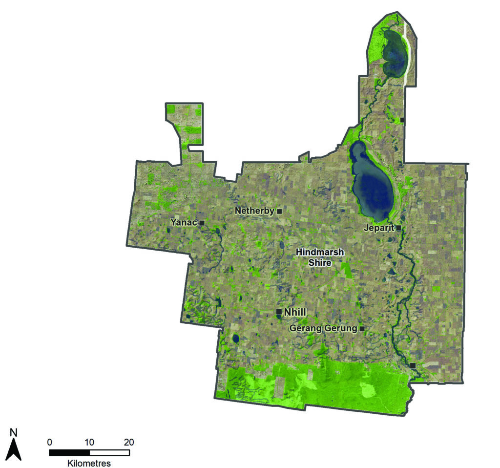
Hindmarsh is bounded by the Little Desert National Park in the south and Wyperfeld National Park to the north. The Barringgi Gadyin (Wimmera River) together with Gurru (Lake Hindmarsh), Outlet Creek and Ngalpakatia/Ngelpagutya (Lake Albacutya) provide a natural corridor that connects the two parks as it traverses through a productive cropping landscape. | |||
The Project Hindmarsh revegetation initiative connects the Little and Big Desert National Parks via roadsides, the Lawloit and Propadollah Ridges and the Barringgi Gadyin (Wimmera River). Commencing in 1998, the Project Hindmarsh planting weekend is a flagship of the Hindmarsh Landcare Network and the longest running event of its kind in Australia. The Hindmarsh Landcare Network is a passionate and active group, providing valuable support to Landcare groups in the region.
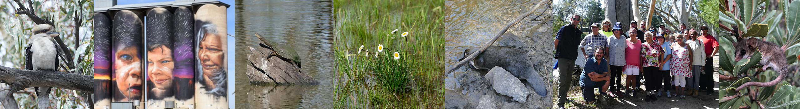
First Nations cultural values are very significant. The high abundance of scar trees and middens is testimony of the profound indigenous connection to Barringgi Gadjyin (Wimmera River) and lakes. In the Antwerp area alone, there are over 250 registered scarred trees (possibly the highest concentration in Victoria). The river was a source of freshwater, plant foods, mussels, fish and bird life. The river continues to influence the cultural landscape today and is an important area for connecting to Country.
In 2005 Barengi Gadjin Land Council (BGLC) and the Australian and Victorian Governments entered into an Indigenous Land Use Agreement. Wotjobaluk people were recognised as having native title rights over the Barringgi Gadjyin (Wimmera River), Outlet Creek, Gurru (Lake Hindmarsh), Ngalpakatia/ Ngelpagutya (Lake Albacutya), Wail State Forest and parts of the Little Desert National Park.
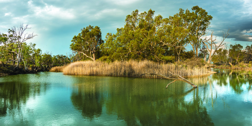
The river and adjacent land support a rich variety of riparian vegetation and aquatic species. River red gum and black box communities form a vital corridor for wildlife habitat and movement through the landscape.
The Barringgi Gadyin (Wimmera River) along with Gurru (Lake Hindmarsh), Ngalpakatia/Ngelpagutya (Lake Albacutya) and Outlet Creek is recognised as the Wimmera Heritage River under the Victorian Heritage Rivers Act 1992. This recognises the important nature conservation, scenic, recreational and cultural values of these waterways.
The river regularly contains water, but only intermittently fills Gurru (Lake Hindmarsh) and beyond, relying on very large floods to generate sufficient flows. When full, Lakes Hindmarsh and Albacutya attract visitors to enjoy water skiing, fishing, yabbying, bird watching and camping. Ngalpakatia/Ngelpagutya (Lake Albacutya) is an internationally significant wetland under the Ramsar Convention, supporting tens of thousands of waterbirds when flooded, the nationally threatened regent parrot (Polytelis anthopeplus) and a unique salt tolerant river red gum.(41) Both lakes are considered nationally important wetlands.(69)
The Barringgi Gadyin (Wimmera River) and lakes system’s Heritage River status recognises the important nature conservation, scenic, recreational and cultural values. There is a strong desire by the Hindmarsh Shire Council supported by the community to build a 103 kilometre Wimmera River Discovery Trail linking Dimboola, Jeparit, Gurru (Lake Hindmarsh), Rainbow and Ngalpakatia/Ngelpagutya (Lake Albacutya). This will be a valuable addition to the region’s visitor economy.
Hindmarsh’s four main towns, Nhill, Dimboola, Rainbow and Jeparit, are co-located with rivers and lakes, reflecting their importance to the liveability of local communities. Waterways support popular annual drawcard events. A study into the socio economic value of recreational and environmental water estimated that the Barringgi Gadyin (Wimmera River) and Nhill Lake contributed $2.1 million to the local economy with more than 41,000 participants in 2019-20.(6)
The Local Area contains 281 wetlands ranging in size from Victoria’s largest freshwater lake, Gurru (Lake Hindmarsh), through to small shallow seasonal wetlands. Many wetlands are important to local communities, often containing abundant bird, wildlife and recreational opportunities. Notable wetlands include Pink Lake, Ross Lake, Nhill Lake, Nhill Swamp, Mount Elgin Swamp, Yanac Swamp and Woorak Swamp.
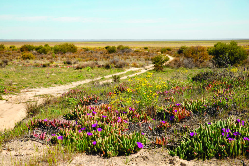
The Little Desert National Park supports a diverse variety of plants and animals. Birds Australia lists it as an Important Bird Area and one of Australia’s Key Biodiversity Areas.(70) There are numerous species across the park, including the nationally threatened Malleefowl (Leipoa ocellata), rare native orchids, western pygmy possum (Cercartetus concinnus), silky mouse (Pseudomys apodemoides) and fat-tailed dunnart (Sminthopsis crassicaudata).(71) Around 50,000 people visit annually, attracted by Spring wildflowers, walking, camping, four- wheel driving, bird and wildlife watching opportunities.(72)
Small patches of native vegetation including endangered remnant Buloke woodlands are scattered throughout the agricultural landscape. Some small remaining areas of native grasslands around Nhill support the critically endangered golden sun moth (Synemonplana).
Region quick stats
 |
Land area | 484,819 hectares |
 |
Population | 5,700 (approximate)(68) Second lowest population density in Victoria |
 |
Population trend | Declining. Aging population |
 |
Main towns | Nhill, Dimboola, Rainbow, Jeparit |
 |
Climate | Semi-arid. Summer temperatures can reach over 40 degrees and regular frosts are experiences in winter. Average rainfall is around 400 mm. |
 |
Land use | 70% of the area is dryland broadacre cropping.(25) |
 |
Main industries |
Agriculture: cropping, wool and sheep meat, major producer and exporter of hay. Health services. Agricultural manufacturing: duck processing, grain handling businesses, silo and grain handling equipment. Tourism is an emerging industry. |
 |
Main natural features |
29% of the area is covered by native vegetation and waterways(25)
|
Assessment of current condition and trends
 Rivers and streams
Wimmera River, Dimboola
Condition is strongly influenced by rainfall, runoff and streamflow. During dry periods, river flows and water quality decline and the river becomes a series of disconnected pools. Salinity levels rise as saline groundwater enters the river and there are insufficient flows to dilute and flush salt into the terminal lakes.
During the Millennium Drought in the 2000s, streamflow declined significantly, and river health was very poor. Salinity levels in some pools approached concentrations well in excess of seawater levels.
Since the end of the drought and large floods in 2010 and 2011, careful management of environmental flows has enabled water quality to be managed by timely flushing with freshwater, filling up and connecting pools, maintaining habitat and refuges, and enhancing instream vegetation. River health parameters have shown gradual improvement over time, except for during droughts (2014-15 and 2018 to 2020-21) when dry conditions saw water flows and quality decline again.
While water quality usually fails to meet State Environment Protection Policy objectives, it has been good enough in most years to support native fish populations, visitor enjoyment of the river, recreational activities and events like fishing competitions and rowing regattas.
Annual fish monitoring results indicate that native fish populations are improving. Carp and other introduced species remain a threat due to their feeding behaviour and propensity to breed in large numbers when conditions are suitable. The improvement in native fish populations and associated surveys indicates that carp impacts are not increasing.
Most of the riparian zone is Crown land managed by Parks Victoria. The river runs through a heavily cropped landscape. Few farmers with access to riparian areas have stock so stock impacts on the river are isolated. There are issues around the number and condition of informal vehicle tracks which creates erosion and facilitates rubbish dumping and illegal firewood collection.
Parks Victoria, Barengi Gadjin Land Council (BGLC), Landcare and Wimmera Catchment Management Authority (CMA) have collaborated in recent years to reduce rabbits and problem weeds like bridal creeper, boneseed (Chrysanthemoides monilifera), horehound (Marrubium vulgare), prickly pear (Opuntia spp.) and wheel cactus (Opuntia robusta). This requires ongoing effort to ensure pests stay in check and weeds are not spread downstream by birds, other wildlife or floods where they could impact on the values of Gurru (Lake Hindmarsh) and Ngalpakatia/Ngelpagutya (Lake Albacutya). Riparian vegetation is mainly continuous and a few small, dispersed areas would benefit from revegetation, particularly in salt affected areas given the lack of ground cover.
The health of culturally significant trees vary from good to poor health due to water quality and availability. More needs to be done to understand and manage these important places.
Wetlands
Lake Hindmarsh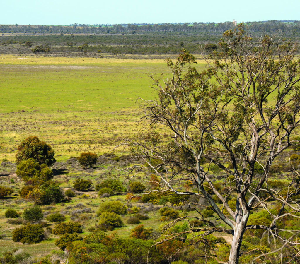
Lake Albacutya
Ngalpakatia/Ngelpagutya (Lake Albacutya) last filled in 1983 and Gurru (Lake Hindmarsh) in 1996. These lakes naturally fill episodically, and ecologists expect that the values the lakes hold when full would return if they filled today.
Parks Victoria, Wimmera CMA and BGLC have collaborated over several years to reduce the impacts of rabbits, motor bikes and four-wheel drive vehicles at Ngalpakatia/Ngelpagutya (Lake Albacutya). This work is facilitating regeneration of endangered Pine-Buloke woodlands and protecting sensitive dune vegetation and cultural heritage.
Other large wetlands like Nhill Swamp, Yanac Swamp and Mount Elgin Swamp are in very good environmental condition and are known to support a vast number and diversity of birds when they contain water.(73) Other wetlands are scattered throughout a heavily cropped landscape. One third of the Hindmarsh Local Area’s 281 wetlands are unmodified by dams, drains, crops and levees, with 189 wetlands (67%) impacted by one or more of these modifications. The number of wetlands wholly or partially covered by a crop doubled between 2004 and 2017 to 126 wetlands affected, potentially causing substantial impacts to the condition of the vegetation and other biota.
 Land
Land
The gross value of agricultural commodities in Hindmarsh in 2015-16 was $103 million of which $62 million was generated from cropping and $41 million from livestock or livestock products. This compares with $186 million (total), $146 million (cropping) and $39 million in 2010-11.(2)
Farmers have adapted to less annual rain by improving land management to maintain soil health and improve productivity, resulting in profound changes over the last few decades. Last century’s farming practices relied on cultivating or tilling soil or burning stubbles, leaving soils bare and exposed after harvest in summer and autumn. The loss of valuable topsoil by wind erosion was a major issue in the Hindmarsh Local Area. Almost 90% of farmers now use minimum–till farming practices, with the vast majority leaving stubble in place over summer. Ground cover fluctuates from year to year but between 2014 and 2019 it ranged from 72% to 95%.
Dryland cropping has gradually increased by 27,000 hectares, covering 70% of the land area.
Past rises in saline water tables have brought salt to the surface, decreasing the productivity of some areas of farmland, particularly west of the Barringgi Gadyin (Wimmera River) corridor. This is a historic occurrence that is not currently worsening as drought and drier climate have seen saline water tables stabilise or fall. Management approaches are seeing saline land reclaimed for production by planting saltbush.
 Biodiversity
Analysis of land cover shows that since 1985(25):
- Native cover has reduced.
- Native grassland or pasture has decreased by 8,000 hectares but has plateaued in the last decade.
- Native shrub cover has halved, decreasing by 5,000 hectares and continues a downward trend.
- Native tree cover has declined by 5,000 hectares but is steady.
- Native scattered trees remain steady at over 3,500 hectares.
Scattered patches of remnant native vegetation are protected in parks and reserves. This includes endangered Buloke woodlands and native grasslands.
Much of the Little Desert’s vegetation is recovering from wildfire and habitat structure is simplified, making it easier for foxes and cats to prey on native species and browsing and grazing animals to impact on regenerating vegetation. Age class diversity is low because of recurrent fire and there are few areas of older aged mature vegetation. Herbivores like rabbits, kangaroos and wallabies have widespread impacts on vegetation, red deer have expanded into the Hindmarsh Local Area from the Little Desert’s western block and goats are potentially an emerging issue.
Major threats and drivers of change
The Hindmarsh Local Area is reliant on agriculture for its economic prosperity. Climate change puts this at risk and farmers are continuing to adapt their businesses as they continue to invest in techniques and technology that focus on soil moisture retention because of reduced rainfall.
Climate change is having a major impact on natural assets in the Hindmarsh Local Area. More hot days coupled with reduced rainfall in the Barringgi Gadyin (Wimmera River)’s headwaters have led to reduced water flows in the Barringgi Gadyin (Wimmera River). Water harvesting higher up the catchment for rural and urban water supply, farm dams have also reduced flows to the lower Barringgi Gadyin (Wimmera River). This in turn impacts on habitat availability, connectivity along the river, and reduced water quality with salinity increasing as flow declines.
Saline groundwater entering the lower Barringgi Gadyin (Wimmera River) is a major threat to water quality and the health of fish, aquatic communities and riparian vegetation. This is especially a problem when river flow is low, enabling groundwater to intrude more readily and better-quality flushing flows are absent.
These threats also impact on aesthetics, recreational values and community wellbeing. For example, healthy weir pools at Dimboola and Jeparit are important for maintaining liveability, supporting recreation, tourism and community events. A healthy river is essential for Wotjobaluk people to facilitate wellbeing and more time On Country in places along the river where they have a deep spiritual and cultural connection.
These factors are driving change in management approach with river managers focusing on ways to protect and maintain the environmental, community and Wotjobaluk values of the river with less water. For example, exploring the viability and opportunities available to deliver water to weir pools, drought refuge pools and the culturally significant Billabong at Dimboola via pipelines or other means.
European carp (Cyprinus carpio) are a threat competing for habitat and resources with native species, stirring up sediment and increasing turbidity and nutrient levels through their feeding actions. Carp comprise a significant biomass in the river although fish surveys are showing steady improvements in the number of native fish compared to carp since the end of the Millenium Drought.(73)
The condition of Ngalpakatia/Ngelpagutya (Lake Albacutya), Gurru (Lake Hindmarsh), Outlet Creek and Ross Lakes is also threatened by lack of streamflows. The wet periods and extremely large flood events required for water to flow to the terminal lakes system are likely to occur less frequently under dry climate scenarios.
Like the Barringgi Gadyin (Wimmera River) and terminal lakes system, the Hindmarsh Local Area’s 281 wetlands are threatened by climate change causing reduced filling regimes, impacting on vegetation and wildlife and waterbirds that rely on water being present. Lack of regular water has left many shallow seasonal wetlands susceptible to being cropped and drained. The ongoing threat of this affecting large numbers of previously uncropped wetlands may be low as the driest wetlands are likely to have been cropped already.
Weeds like boneseed (Chrysanthemoides monilifera subsp. Monilifera), African boxthorn (Lycium ferocissimum), bridal creeper (Asparagus asparagoides) and olives can impact on the integrity of riparian and wetland vegetation and require ongoing monitoring and management to prevent their spread. Floods can act as a vector to further spread weeds along the river system. Rabbits are an ongoing issue threatening the condition of riparian vegetation along the Barringgi Gadyin (Wimmera River), Outlet Creek and beside the lakes and wetlands, particularly in the sandy dune areas characteristically present on the north-eastern side of many wetlands.
The Little Desert National Park and surrounding areas are also subject to rabbit impacts. An overabundance of herbivores including rabbits, hares (Lepus europeaus), kangaroos and wallabies are impacting on native vegetation. Red Deer (Cervus elaphus) have expanded from the park’s western block further east. Goats are an emerging issue, also expanding into the eastern block from the west.
A major threat to the integrity of the Little Desert National Park’s vegetation and habitat quality is fire that occurs too frequently. This is reducing the diversity of native vegetation age classes within the park, simplifying habitat and making it easier for predators like foxes and cats to prey on native wildlife. It is also making it easier for browsing and grazing pest animals to invade and impact on native vegetation.
Increased access by the community to natural areas has the potential for impacts like erosion, vegetation loss, rubbish, damage to cultural heritage such as middens. The activities of visitors to natural areas will need to be carefully managed and impacts monitored to ensure that their values are protected and continue to provide benefits to all users and wildlife.
Desired outcomes for the future
Outcomes to be achieved in 20+ years
- The social, environmental, cultural and economic values and condition of waterways and parks that have formally recognised significance are maintained. This includes:
- Little Desert National Park
- Wimmera Heritage River
- Ngalpakatia/Ngelpagutya (Lake Albacutya) (Ramsar)
- Gurru (Lake Hindmarsh) and Pink Lake (nationally important wetlands)
- Seasonal Herbaceous Wetlands (Freshwater) of the Temperate Lowland Plains (Environment Protection and Biodiversity Conservation (EPBC) Act listed)
- Habitat condition and connectivity are enhanced between the Little Desert National Park, Wyperfeld National Park and the Big Desert and along the Barringgi Gadyin (Wimmera River) system.
- The ecological character of the Ngalpakatia/ Ngelpagutya (Lake Albacutya) Ramsar Site is maintained.
- Soils support productive agriculture and healthy, functioning natural environments.
Outcomes to be achieved in 6 years
- More habitat enhancement and revegetation occur in and connecting the Little Desert National Park, large blocks of vegetation and along waterways and roadsides.
- Ecosystem function in the Little Desert National Park is improved:
- Habitat for Malleefowl and small mammals is improved.
- Pest animal impacts are reduced.
- Significant vegetation is protected and expanded, including orchids.
- Small mammals are reintroduced.
- Opportunities for delivering water to drought refuge pools, weir pools, scarred trees and wetlands to maintain species and provide community benefits are explored and implemented.
- Water quality in the Barringgi Gadyin (Wimmera River) supports fish populations, recreation and important community events.
- More farm trials explore improved practices that contribute to soil health, productivity and less off-farm impacts.
- Most paddocks have at least 80% ground cover maintained throughout the year.
- Visitor numbers to high value natural places are maintained or improved, including the Barringgi Gadyin (Wimmera River) at Dimboola and Jeparit and the Little Desert National Park.
- More natural areas have improved access and are managed to prevent potential impacts associated with access.
- Carp numbers and impacts do not get worse.
- No new pest plants and animals are established beyond small, localised populations.
Priority directions
Integrated Catchment Management (ICM) in this area will focus on:
- Community groups, BGLC, Hindmarsh Shire Council, Wimmera CMA and government agencies working together to improve the opportunities the Barringgi Gadyin (Wimmera River) provides to the community. This will include a combination of environmental improvements and improved management of recreation, access and associated impacts.
- The Victorian Environmental Water Holder, BGLC, Parks Victoria, Grampians Wimmera Mallee Water (GWMWater), Department of Environment, Land, Water and Planning (DELWP) and Wimmera CMA working together to deliver water for the environment to drought refuges in the lower Barringgi Gadyin (Wimmera River).
- BGLC, farmers, Landcare groups, government agencies, Wimmera CMA and stakeholder organisations working together to build corridors of well-managed vegetation between private and public land, particularly along the Barringgi Gadyin (Wimmera River), Little Desert National Park, wetlands and remnant native vegetation.
- Farming groups, farmers and BGLC working together to improve techniques that balance ground cover, farm profitability and improved environmental outcomes.
- Birdlife Australia, BGLC, Parks Victoria, Wimmera CMA, DELWP and volunteers working to improve the understanding and management of threats to Malleefowl (Leipoa ocellata).
- Landcare groups, Parks Victoria, Wimmera CMA, BGLC, Hindmarsh Shire Council collaborating to protect the values of Lake Albacutya, Lake Hindmarsh and Outlet Creek particularly reducing grazing pressure on native vegetation, managing visitor activities that impact on natural assets, habitat and cultural heritage.